Indigenous Wire

Share this post

Quantifying #LandBack

www.indigenouswire.com

Quantifying #LandBack

New Harvard research examines landback options for tribes, states and feds.

Rob Capriccioso
Oct 20, 2022
10
2
Share this post

Quantifying #LandBack

www.indigenouswire.com
(PHOTO BY NICK LACHANCE/NURPHOTO VIA GETTY IMAGES)

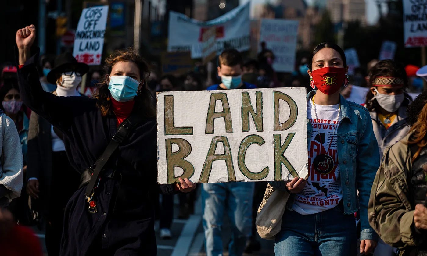
In the age of increased Indigenous everything — representation in entertainment, economics, media, politics, and a growing population — #LandBack has become quite the attractive hashtag on social media.

It’s shorthand for give the lands back to the Native peoples your ancestors and federal and state governments stole from them.

It’s popular. It’s a movement. It gets clicks.

Needless to say, it’s easier hashtagged than done.

Via a new 14-page policy briefing paper, researchers with the Harvard Project on American Indian Economic Development are today attempting to provide tribal, state and federal policymakers another tool to think about where lands are that could be reallocated, given a will and a way.

The way part is there, the authors conclude. In short, their map-filled paper outlines how people may identify lands that historically belonged to Native nations that could be returned by the U.S. and state governments if they want to do so.

One could imagine that some officials — say Gov. Kevin Stitt of Oklahoma, despite being a Cherokee citizen — wouldn’t be much interested in reading this research. His interests, he’s proven time and again, are with the state — not the tribe.

But one could also imagine some feds — say Assistant Secretary for Indian Affairs Bryan Newland, a Bay Mills Indian Community citizen — bringing a copy to one of his frequent meetings with Native U.S. Interior Department staffers, who are attempting to make dramatic progress on this front.

The paper and its accompanying press release note that laws written in the late 19th Century “intended to create opportunities for private ownership and settlement by non-Indigenous people drastically diminished the geography of American Indian reservations.”

In fact, much of this land was originally declared “surplus” and therefore “not needed” by tribes.

Ironically, though, no less than six federal agencies currently still — 140 years later — manage approximately one-third of the supposed surplus land that had previously been within former reservation boundaries, according to the policy release.  

That means that a quarter of land just outside of present-day reservation boundaries (within a 10-mile zone) is managed by one of six federal agencies, largely made up of the U.S. Interior Department’s Bureau of Land Management (11%) and the U.S. Department of Agriculture’s Forest Service (11%), according to the paper itself.

The paper’s authors, Miriam Jorgensen, research director with the Harvard Project, and Laura Taylor, a research fellow with the Harvard Project, make the case that these so-called surplus lands would be an excellent place to start many a landback process.

There are and will be complexities, yes, but this is the most fertile ground (pun intended), they argue.

“Indeed, these areas may provide a cohesive set of initial opportunities towards the aim of landback,” according to the report’s accompanying press release. “In particular, tribal management or tribal-federal/state co-management agreements can present win-win solutions for both public agencies and American Indian nations in expanding tribes’ land stewardship.”

The full report details how techniques using geographic information systems (GIS) can identify public and/or protected land in relation to current and historic reservation boundaries.

It’s the same technology you can use to see if your neighbor’s new fence partially trespasses on your land, and much of this mapping is already available on the internet, accessible by county.

The authors say that this technology “can showcase the scope of landback opportunities, including lands that are: (i) owned by the federal or state governments; (ii) federal- or state-managed within current external reservation boundaries; (iii) existing within former reservation boundaries; (iv) near or abutting current reservation land; or (v) protected areas designated for conservation management.” 

They "conclude that identification of where these parcels are, especially in relation to current or former reservation land, is a powerful first step for tribes and federal and state government agencies as they mutually begin to develop strategies for the return of land to tribal nations.”

Sure, it’s a more complex conclusion to hashtag than #LandBack, but it may provide a real path forward.

Indigenous Wire is a Native-owned, reader-supported publication. To receive new posts and support our work, consider becoming a free or paid subscriber.

2
Share this post

Quantifying #LandBack

www.indigenouswire.com
2 Comments
Robert Keesecker
Oct 20, 2022

This is so encouraging. The most important thing thoughtful people can do with this information you have provided us, Rob, is to be pro-active. Don't think "This is great. The government is doing some good things. Well, moving on. Time for dinner." The best way to do that is communicate (in a constructive and respectful manner, even though it may be difficult to show respect to some of these morons), with our respective congressional representatives. And keep at it.

Expand full comment
Reply
1 reply by Rob Capriccioso
1 more comment…
TopNewCommunity

No posts

Ready for more?

© 2023 IndigenousWIRE, LLC
Privacy ∙ Terms ∙ Collection notice
Start WritingGet the app
Substack is the home for great writing